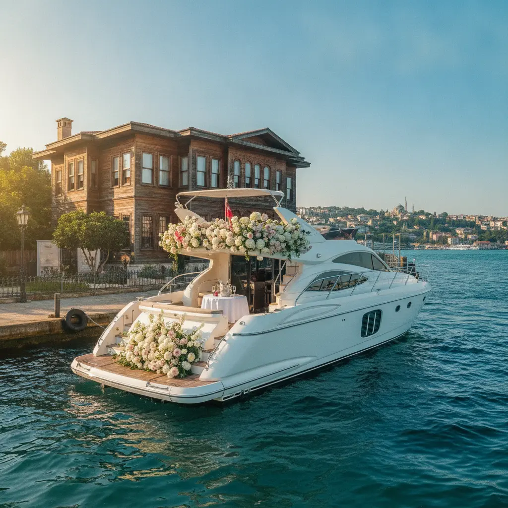
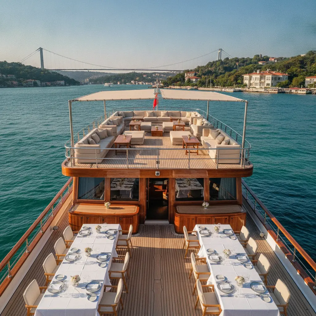
Bosphorus Yacht Charter: Northern Route & Coastal Villages
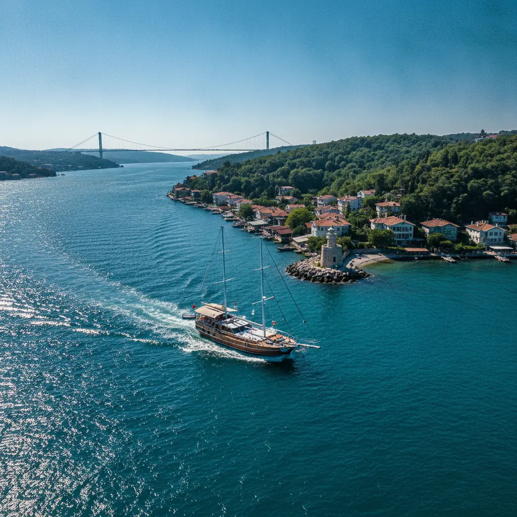
Almost every yacht charter conversation in Istanbul starts with the same question, and it is never about the boat: "how far north can we actually go?" The answer has less to do with engine power than with how you build the day. South of the second bridge the Bosphorus is scenery. North of it, the strait becomes navigation. The water widens, the waterfront apartments thin out, and the coastline turns into fishing harbours, pine-covered slopes, two lighthouses and a handful of village cafés where nobody is in a hurry.
This guide is for people planning a Bosphorus yacht charter who have heard the phrase "northern route" and want to know what it actually involves: which villages are worth stopping at, why the current decides your schedule before you do, and which kind of group fits which itinerary. If you are arriving at the marina by road, sorting out premium chauffeured car rental in advance matters more than it sounds, because northern-route departures happen early and the morning is the one part of the day you cannot buy back.
Where the northern Bosphorus actually begins
The practical border is the Fatih Sultan Mehmet Bridge. South of it, Emirgan, İstinye, Yeniköy and Tarabya still behave like an extension of the city: waterfront mansions, piers, people jogging at seven in the morning. Cross under the bridge and the profile changes. On the European shore you pass Kireçburnu, Büyükdere, Sarıyer, Rumeli Kavağı, Garipçe and finally Rumeli Feneri. On the Anatolian side the sequence runs Anadoluhisarı, Kanlıca, Çubuklu, Paşabahçe, Beykoz, Umuryeri, İncirköy, Anadolu Kavağı, Poyrazköy and Anadolu Feneri.
The geography explains a lot. At its narrowest, between Rumelihisarı and Anadoluhisarı, the strait is only about 700 metres across. At its northern mouth, where it meets the Black Sea, it opens to more than three kilometres. That means the further north you go, the less the Bosphorus feels like a channel and the more it feels like open water. Which is precisely why boat choice and weather windows are far less forgiving on this route than on a short city cruise.
Four signals tell you that you have entered the northern section:
- The bridge crossing. Past the second bridge, the unbroken line of waterfront mansions ends and gives way to gardens, small boatyards and fishing shelters.
- The traffic changes. Leisure boats thin out and commercial shipping becomes obvious. Your captain's attention shifts from the view to the radar and the traffic separation scheme.
- The water darkens. The surface current arriving from the Black Sea changes both the colour and the temperature. Salinity drops, the water cools, and swimming stops feel bracing rather than bathtub-warm.
- The noise fades. The city hum disappears. What is left is gulls, anchor chain and wind.
Village by village: the northbound line
It is a mistake to think of the northern route as one continuous strip. The European shore has closely spaced piers separated by shallow bays; the Anatolian shore is steeper, with coves that feel more enclosed. The order below is the backbone of a typical day, running south to north.
İstinye, Tarabya and Büyükdere: where the day starts
These three bays are the most practical departure points for the northern route. İstinye combines a marina with easy city access and is the most popular starting line. Tarabya forms the first real bend on the way north; after it the coastline becomes more broken and much less built up. Büyükdere, with its pier and old summer-house feel, offers a calmer start to the morning.
Leaving one of these bays between 08:30 and 09:30 is the single most important decision of the day, and it comes down to current. The surface current in the Bosphorus runs from the Black Sea towards the Marmara. Going north you are pushing against it; coming back you ride it. A boat that leaves early climbs north in calmer water and lighter traffic, then returns faster with the current behind it. Start the same itinerary after lunch and you spend twice the fuel and twice the patience for exactly the same coastline.
Sarıyer and Rumeli Kavağı: the first real village
Sarıyer is the threshold between city and village. Step off the pier and you have fishing boats on one side and börek shops on the other. Sarıyer böreği, the thick spiral pastry sliced from a tray, is the local institution and the most practical breakfast you can carry onto a boat. It also removes any need to plan lunch before noon.
Rumeli Kavağı is where the route changes character. A small fishing harbour, a few restaurants, narrow streets and old stone traces on the hill above. You do not need to go ashore here for it to be worth it; slowing down and drifting past the waterfront is enough. The short stretch between Rumeli Kavağı and Rumeli Feneri is one of the least visited and most photogenic pieces of coastline on the whole strait.
Garipçe: the village under the third bridge
Garipçe is the stop most visitors have never heard of, and it is one of the strangest sights on the route. The European leg of the Yavuz Sultan Selim Bridge rises directly above the village, so from the water it looks as though the bridge simply ends on top of a fishing hamlet. There is a small pier, a couple of fish restaurants and a steep slope behind them.
Two things are worth knowing. First, Garipçe is exposed; when the poyraz is blowing, anchoring is uncomfortable and most captains treat it as a short pause rather than a long stop. Second, the coastline immediately north of the village and the Poyrazköy shore opposite include restricted military zones. This is not the place to improvise a swim stop. Stay with the cove your captain points to, and you stay both safe and legal.
Poyrazköy: fishing harbour and quiet
On the Anatolian side, tucked beneath the third bridge, Poyrazköy is one of the most authentic pauses on the northern route. A small fishing shelter, a coffee house, a few fish restaurants and narrow lanes climbing the hill. The water here no longer behaves like a strait; it sits somewhere between a lake and open sea.
Part of the village falls within a military area, which means wandering ashore at random is not an option. The compensation is calm: this is an excellent place for a long lunch. Either anchor off the harbour and eat at the stern, or take the tender in for a restaurant meal. Captains know this stretch well, so simply ask whether a Poyrazköy stop fits the plan.
Anadolu Kavağı and Yoros: the high point
Anadolu Kavağı is the classic finish of the northern route, and from the water it shows two layers: the pier, fish restaurants and boat traffic below; the ruins of Yoros Castle above, with the Black Sea behind them. Yoros has served as a lookout since Byzantine and Genoese times, and it still does the same job today, watching the northern wind and the shipping lanes.
Timing is everything here. By midday the pier is crowded and restaurant tables are contested. A boat that arrives early can climb to the castle first, take in the view, and eat on the way back down. Do it the other way round and you walk uphill in the heat and delay your departure. On the northern route, the rule "see the high point first, eat afterwards" saves an hour.
The two lighthouses: Rumeli Feneri and Anadolu Feneri
At the mouth of the Bosphorus, two lighthouses face each other across the water. Rumeli Feneri is a stone tower built in the mid-nineteenth century; Anadolu Feneri is its twin on the opposite shore, from the same period. The distance between them looks short from the deck, but this is one of the most demanding stretches on the entire strait: commercial traffic, strong current and wind all converge in the same place.
The village of Rumeli Feneri feels like the end of the line. A small cove, fishing boats, a couple of cafés. Beyond it, there is only the Black Sea. Some captains run out as far as the lighthouse and turn back, and the point of that manoeuvre is less the view than seeing where the Bosphorus officially stops. Actually exiting into the Black Sea is a separate plan, requiring a different boat and a wider weather window.
Current, poyraz and traffic: the three things that set your schedule
Most articles about the northern Bosphorus list the stops and skip the sailing. But the day is shaped by three variables, not by the villages.
Current. The surface flow runs from the Black Sea towards the Marmara, while the undercurrent runs the other way. Near the northern entrance the surface current strengthens noticeably, at times approaching two to three knots. Going north that means more fuel and more time. Experienced captains therefore put the north in the morning and the south in the afternoon.
The poyraz. In summer, the north-easterly poyraz roughens the northern mouth through the afternoon. Water that is glass at nine in the morning can turn into short, confused chop by four. On this route your return time matters more than your departure time. If you are still drinking coffee in Anadolu Kavağı at 16:00, you have already chosen a long, bumpy ride home.
Commercial traffic. The Bosphorus is one of the busiest passages in the world, and tanker and freighter traffic increases in the north. Yacht captains follow the traffic separation scheme rather than the shortest line, and they slow down more often than guests expect. Build a buffer into the plan: rather than applying a chart distance exactly, add roughly twenty per cent.
Three practical notes on the water itself:
- The main channel is not a swimming pool. Swimming in the navigation lane is both unsafe and prohibited. Swim stops happen in sheltered coves your captain selects, with the boat fully stopped.
- Hugging the shore is not always faster. Shallows and fishing gear can make a close-in line longer. Ask your captain why a certain track was chosen; the answer is usually useful.
- Have a fallback. If the weather turns, cutting the route at Anadolu Kavağı or Poyrazköy and heading back is the decision that saves the day.
Three route templates that actually work
The northern route works at three different lengths. These templates apply regardless of boat type.
1. Half day: Tarabya to Rumeli Kavağı (4 hours)
Morning departure, past Tarabya and Büyükdere, a short stop at Sarıyer, on to Rumeli Kavağı and back. This is the most balanced option for first-time charterers, families with small children and anyone with limited time. Swimming stops work best in the calmer coves just north of Büyükdere. Because the current pushes you home, the return usually takes less time than people budget for.
2. Full day: İstinye to Anadolu Kavağı (7-8 hours)
This is the classic northern route. Leave around 09:00, run up the European shore, pause off Garipçe, pass beneath the third bridge, stop at Poyrazköy for lunch or a swim, go ashore at Anadolu Kavağı for the pier and the castle, and finish at Rumeli Kavağı on the way back. İstinye to Anadolu Kavağı is roughly ten nautical miles, a little over an hour at ten knots. Add stops, food and swimming and the day fills without effort.
3. Beyond the lighthouses: a Black Sea extension
Passing between Rumeli Feneri and Anadolu Feneri and continuing into the Black Sea is a step up in boat and crew experience. A short run towards Kilyos (Kumköy) on the European side or towards Şile on the Anatolian side is possible, but only with a wide weather window and a boat genuinely suited to open water. Overnight stays inside the Bosphorus are uncommon; if you are planning one, settle the return timing and marina logistics before you book.
Who should book this route: four groups, four different days
The same coastline produces a completely different day depending on who is on board. Matching group type to itinerary is the real planning work.
Families with young children
For families, the advantage of the northern route is space and quiet; the drawback is longer passages. The right structure is half a day, two stops and one swim. A motoryacht or a wide-decked gulet works better than a low racing hull, because shade and fixed seating matter when there are children aboard. Plan to be back before 16:00, which removes the risk of a long return in afternoon chop. At Anadolu Kavağı, staying on the pier rather than climbing to the castle is a perfectly good ending for this age group.
Couples
For couples the appeal is that the route only starts to feel special where the crowds end. A small classic boat, a two-person crew, a short pause at Rumeli Feneri, an anchorage in a quiet cove on the way back. Do not compress the schedule: two stops rather than four, five hours rather than three. Eating lunch ashore at a fish restaurant leaves a stronger impression than catering on deck, and Rumeli Kavağı and Anadolu Kavağı are the two best places for it.
Groups of friends
With friends, capacity and sound system decide the boat. For ten to twenty people a gulet offers the deck space and the food-and-music layout that a small motoryacht cannot. The best version of the day: early departure, a long swim stop at Poyrazköy, a walk around Anadolu Kavağı, and a fast, current-assisted run home. The one discipline required is not letting the return slip for the sake of one more song; the afternoon poyraz does not negotiate.
Corporate groups
For corporate events the northern route works better than the southern one because it genuinely feels like leaving the city. Gulet charters of 40-60 guests can accommodate a presentation setup, a microphone and catering. The planning difference is precision: keep the number of stops low and announce pier departures in advance. Landing sixty people at a busy pier like Anadolu Kavağı costs time, so run the programme on board and give the group a single short shore break instead.
Choosing the boat and the checklist before you pay
Boat selection is less forgiving on the northern route than on a short city cruise, simply because of distance, more open water and more variable weather. The differences between a gulet, a motoryacht and a sailing yacht become real here. A gulet gives you deck space and comfort for larger groups, but its cruising speed of around ten knots eats time on a longer route. A motoryacht is faster and more flexible, the most efficient choice for small groups and couples. A sailing yacht is a joy in steady wind and tiring when the poyraz is up.
Settle these six points before booking:
- Passenger licence and insurance. Ask whether the vessel is certified to carry paying passengers. It is both the legal and the safety filter.
- Capacity versus deck space. A boat listed for twenty is not necessarily comfortable for twenty. Ask about life jacket numbers, including children's sizes.
- Is fuel included? A longer route increases fuel cost. Get fuel, crew and cleaning written into the quote.
- Crew numbers. Is there anyone aboard besides the captain? For larger groups, service and safety depend on it.
- Route flexibility. What happens if the captain changes the plan for weather? Reputable operators say so upfront.
- Food and drink policy. Can you bring your own, and is there a service fee? On this route, eating ashore is also a real option, so agree on it in advance.
Eating ashore: what the coastal villages are known for
Half of the northern route happens on land. Sarıyer means börek, Kanlıca means yoghurt, Anadolu Kavağı means fish, and Rumeli Kavağı means a small restaurant where the menu depends on the morning's catch. Kanlıca yoghurt, served with icing sugar, is one of the Bosphorus' best-known small rituals; if your route passes the Anatolian shore, a single bowl is enough to complete the day.
In the fish restaurants, season is what matters. In the northern Bosphorus, lüfer and palamut come into their own in autumn, while summer favours mezgit, istavrit and sea bream. Asking "what came in today?" is more reliable than assuming everything on the list is fresh. The restaurants around the Anadolu Kavağı pier fill up at lunchtime; sitting down early makes a real difference to both service and the view.
Season, hour and light
The comfortable window runs from late May to early October, with June and September the most stable. July and August are the busiest and hottest, but there is a quirk worth knowing: the northern Bosphorus is a few degrees cooler and noticeably windier than the city centre. On a hot summer day that is an advantage; on a cool morning it means packing a light windproof layer.
September is the best-balanced month for this route. The sea is still warm, the crowds have thinned and the fishing season is about to turn. October is when the restaurants and fishermen come alive, at the cost of a narrower weather window. Between November and April the route does not close, but planning becomes weather-dependent: a lodos day turns the Bosphorus grey and wet, and without an enclosed saloon the day loses its charm.
The rule for timing is simple: north in the morning, home in the afternoon. Current, wind and crowds all agree with that arrangement. If you want to end the day with sunset light, plan to watch it from a cove in the north rather than while approaching the city, and shift your return calculation accordingly.
Mistakes that flatten a good day
- Planning the route as a one-way trip. It is an out-and-back. Return time varies with current and wind, so assuming a fixed hour breaks the plan.
- Trying to land at every village. Four pier stops means spending half the day waiting at piers. Two stops and one swim is far more satisfying.
- Hitting lunch at the worst hour. 13:00 at Anadolu Kavağı is the hardest slot. Eat early or eat aboard.
- Ignoring the forecast. The poyraz and the lodos are two different days on the same water. Checking the day before is cheaper than cancelling.
- Confusing listed capacity with usable deck. A twelve-guest boat is not automatically a twelve-guest living room.
What to hold on to
Mention a Bosphorus yacht charter and most people picture the southern route: the Maiden's Tower, the mansions, the evening lights. The strait's real character, though, is in the north: fishing shelters, two lighthouses, the villages under the third bridge and that wide mouth where the water stops behaving like a channel. The northern route asks for more planning and repays it generously.
Fix three things when you plan: an early departure, two stops rather than four, and a buffer for the return. Let the captain and the weather handle the rest. Starting the day with premium chauffeured car rental to the marina removes the early-morning pier scramble, and the same arrangement at the end of the day rescues a tired return. On the northern route, the best moments come when you keep to the plan without being ruled by the schedule.